
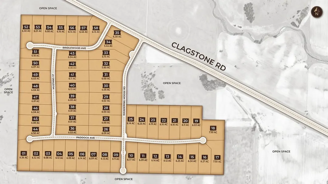
It is one of the first questions people ask, usually standing on the ground with their arms out, guessing at a line. How close to the edge can I build?
The county has an answer and it is shorter than you expect. In the Rural zone, where all fifty-eight of these homesites sit, Kootenai County asks for twenty-five feet from the front line, ten feet from each side line, and fifteen feet from the back. A second street on a corner wants fifteen. That is the whole of it, and it is the same rule that applies to rural parcels across the county.
The plat does not invent its own version. Its restrictions note simply points at the county: all setbacks to be in accordance with Kootenai County code requirements for the Rural zone. So the numbers above are the county’s own, out of section 8.2.207 of its Land Use and Development Code.
Now put them on a six-acre homesite and watch them almost disappear.
Take a lot three hundred feet across and nine hundred deep, which is close to the shape of most of these. Pull in twenty-five feet at the road, fifteen at the back, ten along each side. You have gone from about 6.2 acres to about 5.5. You kept nine tenths of your ground, and the strip you gave up is mostly the bit nearest the road you were never going to put a house on anyway.
That is the part worth understanding before anyone starts worrying about lines. The county setbacks are real, they are enforced, and on a parcel this size they are the least of the things standing between you and where the house goes.
Where the front line actually is
One detail matters more than it sounds like it should. The code measures a road setback from the edge of the right of way rather than from the pavement, and out here those are a long way apart.
The roads through this plat sit in sixty-foot rights of way. The pavement is twenty-eight feet of that, so there is sixteen feet of shoulder and ditch on each side of the asphalt before you reach your own property line. Your twenty-five feet starts at that line, not at the edge of the blacktop. In practice that puts the front of your house about forty feet back from the edge of the asphalt, and fifty-five from its centre line, without you doing anything clever.
We measured this across all fifty-eight lots rather than taking it on faith: the road-facing property line sits thirty feet off the centreline on lot after lot, which is exactly half of a sixty-foot right of way.
The setbacks that actually bind
Here is the one that matters, and it is not the county’s.
The plat carries two special setbacks of its own, and they are not small. One requires three hundred and seventy-five feet from a north property line. The other requires four hundred and seventy feet from an east property line. Both apply to all primary and accessory buildings, not just the house.
On a lot nine hundred feet deep, a three hundred and seventy-five foot setback takes better than a third of your depth before you start. That is not a detail a builder wants to meet late.
What really decides it
Once you have the lines, the things that shape where a house sits on six acres are almost all bigger than twenty-five feet.
Fire comes first. The defensible space the fire districts ask for runs to a hundred feet of managed vegetation around the building, which is four times the deepest setback the county asks for. That is thinning rather than clearing, and we wrote the whole of it up in defensible space is not a clear-cut. If anything is going to move your house, it is that.
Then the driveway. Every foot between the road and the house is a foot you build, plough and maintain, and on parcels this deep that number gets real quickly.
Then water and waste. The well and the drainfield each need their own room, and a septic system here is your own, on your own acreage, permitted through Panhandle Health District rather than by the county planner. How septic works here covers that side.
And then the ground itself. These parcels fall between five and nineteen feet across their length, which is gentle, but a house wants the flat part and the view usually wants the other end.
You can try it
The homesite sketchpad on every lot page now knows the county’s figures. Drop a house on the parcel, drag it where you like, and it will tell you how far you are from the nearest property line and whether that clears what the code asks for. When it does not, it says by how much.
It draws no buildable envelope, deliberately. We tried, and on parcels whose boundaries are surveyed curves the shape it produced was wrong enough to be misleading, so it reports the number instead of shading a picture we would not stand behind.
Updated September 25, 2026.