Clagstone Country EstatesContact

What comes with the lot

More than the land.
The wires, the water, and the walk to the mailbox.

Fiber to every homesite from the day of occupancy, three-phase power in the corridor, twenty acres of shared open space at the center of the plat, curbside trash pickup as the houses go up, and a real entrance where the school bus pulls fully clear of the travel lane. What a lot comes with here, before you build.

Before the list

Most of this was somebody else's problem.

Buy six acres in North Idaho and you usually inherit a list of unknowns. Whether there is water, and how deep. What the power company will charge to run a line. Which internet is genuinely available at the address rather than on a coverage map.

Here those were settled before the first lot was offered, and the answers are already in the ground. That is the unusual part, and it is worth saying plainly, because anyone who has shopped rural land before arrives expecting the list. What follows is what a Clagstone lot comes with, and what each one means once you are standing on it.

Internet · Fiber

Fiber to every lot.
Multi-gigabit from day one.

A dedicated broadband agreement negotiated for Clagstone lands multi-gigabit fiber service at every homesite from the first day of occupancy.

Fiber does exist in Kootenai County, mostly clustered in the cities and along the routes carriers have already trenched. The Highway 54 corridor around Athol is thinner: many properties out here still choose between cable, DSL, and satellite, depending on which pole line their driveway reaches. Whether a specific address has fiber is worth checking rather than assuming.

  • Symmetrical multi-gig service.Multi-gigabit up and down. Actual upload speeds that don't fall off a cliff. Real remote-work grade internet, with room to grow.
  • Available from the day you close.The arrangement is in place before the plat clears. A new homeowner walks into service the same week they walk into a house, without a lead time measured in months and without a satellite dish as a placeholder.
Homesites served
Every lot
Service on day one
Multi-gig

Power · Electric

Three-phase available at every homesite.
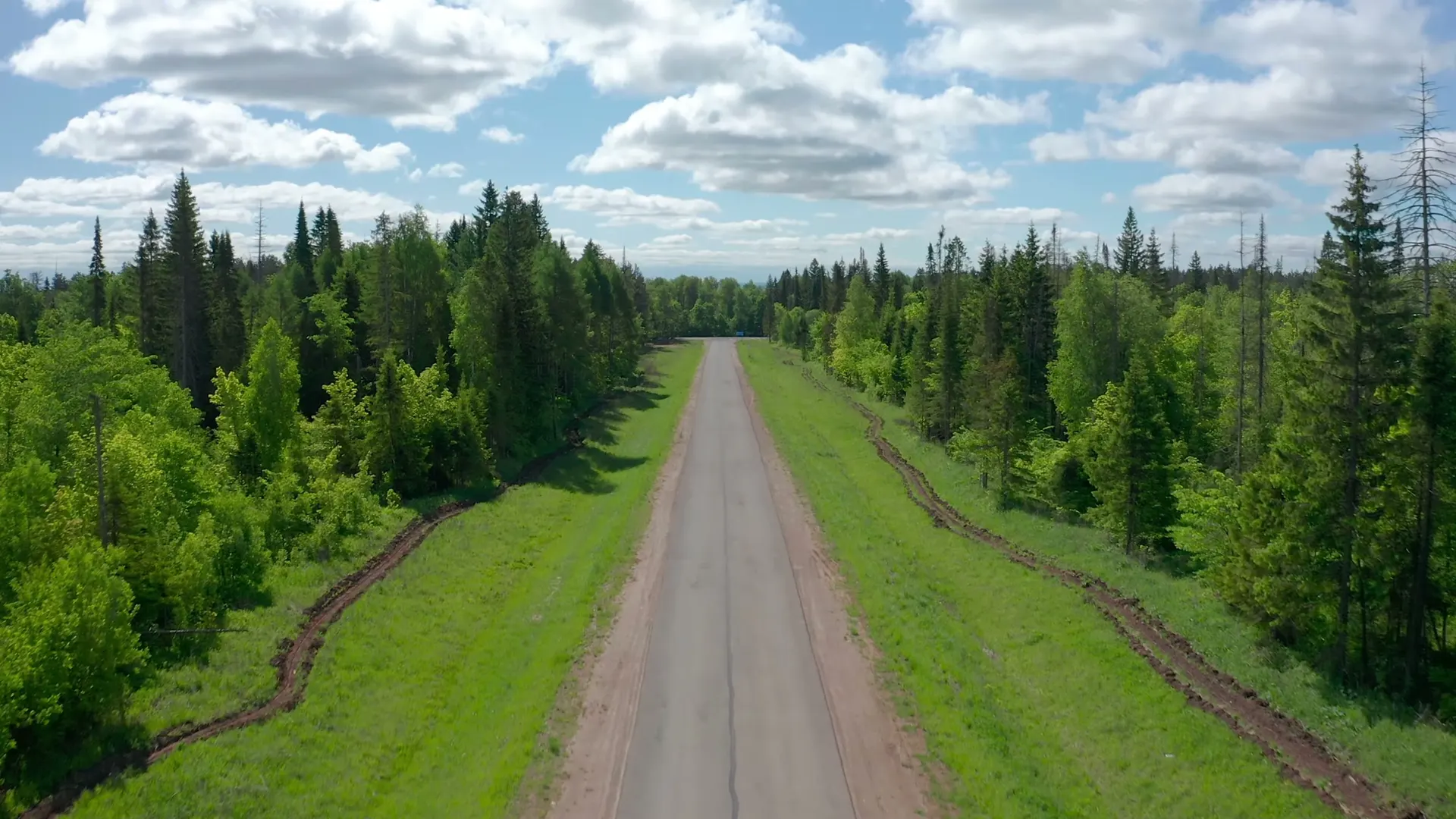
Northern Lights has three-phase service available at every lot, in conduit alongside the roads. Three-phase is what makes a real shop possible: welders, dust collection, machine tools that would dim the lights on a residential panel, DC fast charging without a special install. Requested per lot at build time.

Natural gas from Avista arrives in the same corridor, so heat, range, and tankless water run on a meter at the frontage instead of a propane calendar.

Aerial looking straight down a paved road running dead straight through conifer timber, grass verges and freshly worked earth along both shoulders, and no utility poles anywhere in the frame.
The corridor on the property, from the brand film. The power and the gas run below the worked ground along the shoulders, so there is nothing of them to photograph. What you can see is the part that lasts: no poles, and no line of them across the view for the next hundred years.
Read the three-phase story →

Water · Community system

Water you do not have to drill for.

A community system serves every homesite from two wells and a water storage facility on Tract C: 5,478 feet of six inch main buried five feet down, five fire hydrants on the line, and a one inch service stubbed to every lot. Most rural six acre lots hand you a drill rig and a hope about depth and quality. This one hands you a tap.

The reason it works is underneath: the Spokane Valley-Rathdrum Prairie aquifer, reached once and properly on behalf of the whole neighborhood rather than lot by lot.

Wastewater is the half that stays yours. Every lot carries its own septic system, permitted through Panhandle Health District, and six acres leaves it all the room it needs.

The base of a red fire hydrant, its pressure rating cast into the iron, standing in a ring of bare grass with snow drifted up all around it
Not ours. The maintenance sticker on it says Smithers, British Columbia. Five go on the main here, and February treats them all the same.

Trash pickup

The route arrives with the neighbors.

Curbside pickup comes to Clagstone in step with the houses. The county requires a residential hauler to be signed on before the final plat goes in, and the route to start once fifteen homes are built. Until then the first owners make the same run most multi-acre properties along Highway 54 make, to the county's rural collection site in Athol. After that, the cans go out at the frontage.

Between pickups, trash lives indoors or in a bear-resistant can. That is Idaho Fish and Game's guidance, and it is written into the neighborhood's approval.

The entrance · Tract B

The first hundred feet belong to everybody.
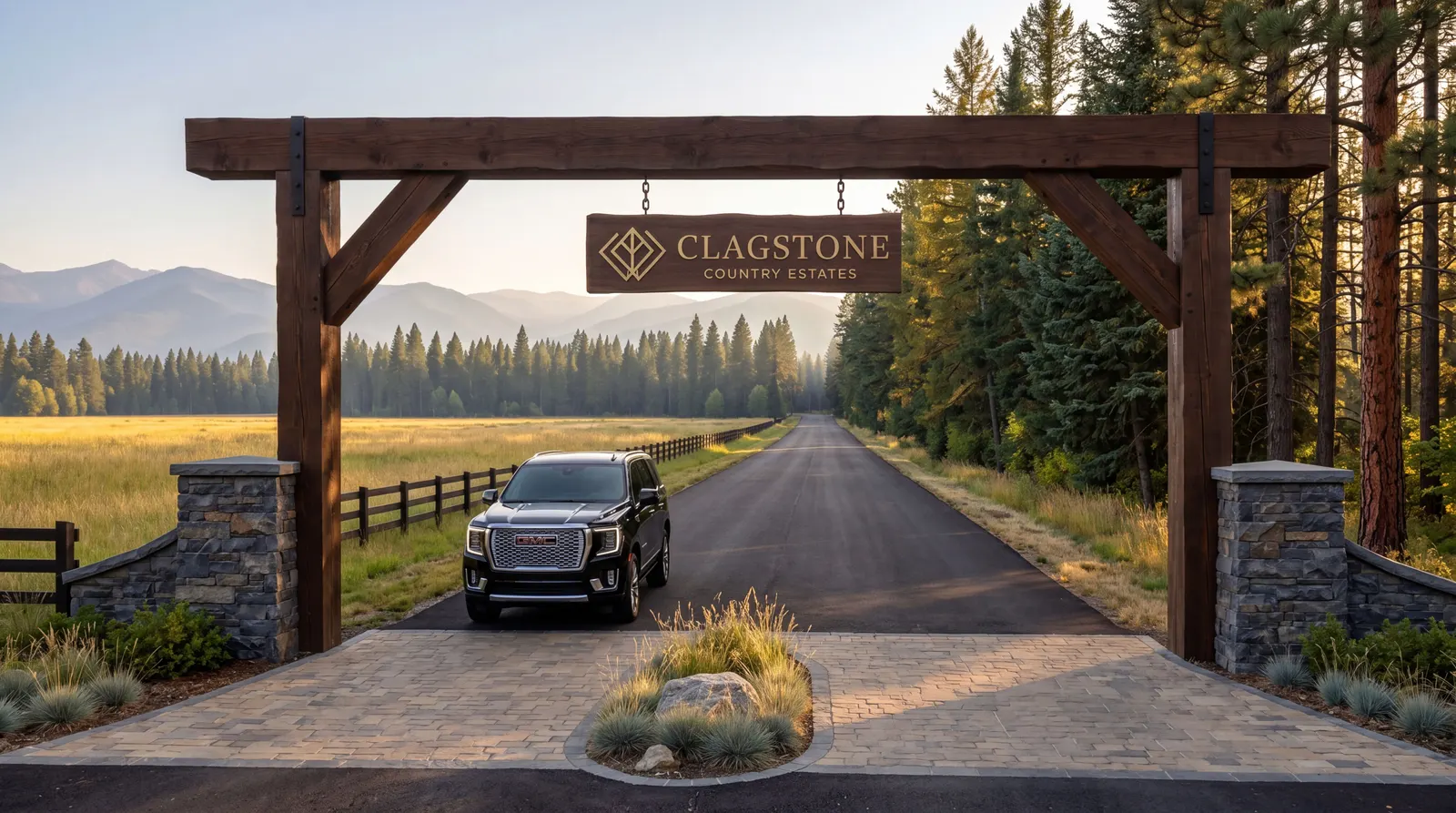
The entrance off North Clagstone Road is its own shared tract, and it carries the three things a rural neighborhood actually uses every day.

An artist's rendering of a timber post and beam arch over a paved lane, a hanging sign reading Clagstone Country Estates, stone piers either side and a rail fence running out along a meadow toward timber
An artist's rendering, not a photograph. Nothing here is built yet and no entrance design is on file, so read it as a mood rather than a plan. The tract underneath it is real, and it is drawn on the approved construction plans as Tract B.

The bus stop

A real school bus stop, drawn on the plans as its own turnout so the bus pulls fully clear of the travel lane. Winter mornings happen at the road with the neighbors, not at the end of a long driveway alone. Where the bus goes.

The mailboxes

Cluster mailboxes in the same turnout, one covered place a neighbor drives past anyway. Mail and packages land together instead of scattered down four streets of individual posts.

The information center

An entrance kiosk carrying the plat, the covenants, and the notices a neighbor is likelier to actually read on the walk to the mailbox than in an email.

Shown on the approved construction plans as Tract B, at the entrance. The rest of the land story →

The shared open space · Tract A

Twenty acres,
held in common.
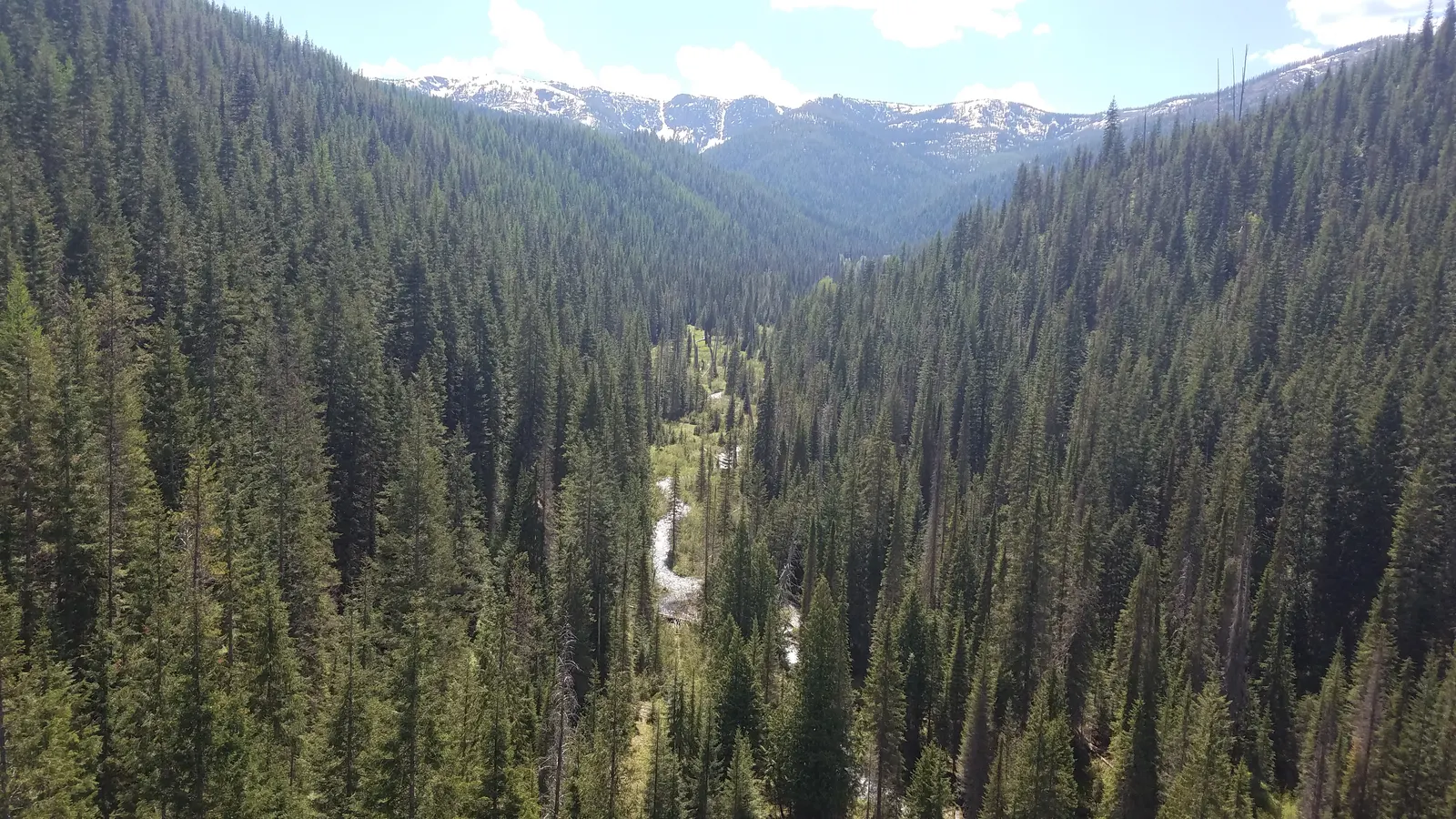
Tract A runs through the middle of the plat as nineteen and change acres of shared open space. It is not a lawn to be manicured. It is country the neighborhood keeps in common, the same walkable ground the wildlife already uses, with trailheads that connect into the Idaho Panhandle National Forests about fourteen miles up the road at Bunco.

Ridge lines stay open by covenant. Nothing on the horizon rewrites itself while the plat matures. The view a walk earns today is the view a walk earns in thirty years.

A timbered valley in the Idaho Panhandle National Forests, a creek threading the bottom of it and snow still lying on the peaks beyond
Idaho Panhandle National Forests, about fourteen miles up the road at Bunco. Not Clagstone, and not the twenty acres. It is the country the trailheads point at once you walk off the end of them.
Shared open space
~20 ac
Ridge lines
Protected
Trailhead into IPNF
14 mi

The pathways · on foot and on horseback

You ride out from home,
not from a trailer.

Pedestrian and equestrian pathways run along the road rights-of-way and between the homesites, and the homeowners association maintains them under the covenants. That second half is the part that matters. A trail somebody intends to build is a sentence in a brochure. A trail written into the covenants is ground you can still ride in thirty years, whoever owns the lot next door by then.

It is not an amenity that got added on top of the plan either. When Kootenai County's hearing examiner wrote up why this subdivision belonged on this ground, she picked out two things.

The proposed project as presented includes two features in particular that reflect an awareness and sensitivity to the natural environment by providing open space for recreation and wildlife with the open space tract and the pedestrian and equestrian trails that will encompass the property.

Hearing Examiner analysis, Order of Decision, Case No. MSP24-0001

The twenty acres above and these paths are the same argument, made twice. Together they are what the county found justified building homes here at all, which is a stronger thing to be able to say than that we thought trails would be nice. The street names were not an accident: Bridlewood, Mustang and Paddock were on the plat before any of this was approved.

What we are not going to do is give you a mileage figure we have not measured. The pathway layout is an exhibit in the county file and it is a condition of the approval that it gets shown on the final plat alongside the road dedications. Until we can draw it accurately on the map on this site, the honest version is that the paths are required, they are maintained, and they connect the homesites to the shared ground rather than making you drive to it.

Open to
Foot and horse
Maintained by
The HOA
Status
Condition of approval

The Design Review Board

Written into the covenants.
Seated when the neighborhood is.

A Design Review Board is written into the covenants and takes up its work the day it is seated. Until it is, the covenants stand on their own text: ridge lines stay open, shared open space stays country and is not a lawn to be manicured.

The board is a neighborhood seat, not a management company with a fax number. The people making decisions live inside the plat. That is the whole idea.

The rest of the land story

Homesites of six acres, give or take, on public paved roads, on a PE-stamped plat by Olson Engineering.

See the plat →

Walk the commons.
Walk the timber.

The tracts are drawn on the ground already. Come see where the entrance is and where the open space begins.